Read this article, and start seeing them everywhere: Xplorer Maps. The hand-drawn story maps feature epic locations around Montana, the United States, and the world. From prints and home or office decor to clothes, games and more, Xplorer Maps products are hiding in plain sight around Missoula, once you know where to look.
“We actually have an endcap dedicated to them solely,” said Kristen Keith, assistant manager at Montana Ace at Tremper’s. “As of right now we just have Flathead, Glacier, Montana, and Yellowstone, so kind of our surrounding Montana areas and highly visited sites.”
Shopping at Ace, you might happen upon the display, or might come in with a specific goal.
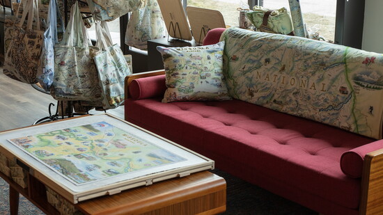
“I recently helped a gal who was buying for her lake house, an Airbnb situation. She wanted to feature something from Montana,” Kristen said, noting that Ace carries Xplorer Maps’ mugs, coasters, playing cards, blankets, puzzles, and dish towels, among other products.
You might also see Xplorer Maps products at local businesses—or even at fundraising events for local nonprofits. That’s how it was for Amy Frandsen, practice manager at Missoula Family Medicine.
“Featuring local products or showcasing Montana in general is important to us and something I think about with decor,” she said. “All of the rooms actually have artwork I have picked up at silent auctions.”
It’s fitting that Xplorer Maps’ products are so popular in Missoula, since founder Greg Robitaille recently fulfilled a longstanding goal of producing a Missoula map, in collaboration with Destination Missoula. Ten percent of proceeds benefit Destination Missoula, and sales of limited edition prints go to the River Ambassador Program, designed to guide river users toward sustainable practices.
“I feel it’s the most important resource we have,” Greg said of Missoula’s rivers, where he likes to unwind each day after work. “It’s great conversation, great people watching.”
The list of locations to feature on the Missoula map started in the seventies and had to be whittled down to roughly half that, with four larger illustrations anchoring the map.
“We didn’t want it to be just downtown, yet so much of who we are is downtown, from the river to the festivals to the arts,” Greg said. A committee of nine eventually arrived at the four anchors: Mount Jumbo, smokejumpers, the carousel, and the Clark Fork.
Greg’s brother Chris Robitaille, who lives in Kenya, hand draws each map. While working on a map, the brothers Zoom a couple times a week and email lists of places, references for artwork, and draft illustrations back and forth. With so much detailed, original art, the process takes significant time. “If we’re working with a partner, I’m working now on maps that are coming out in 2026 and 2027,” Greg said. “Our lead time is 18 to 24 months.”
True to that standard, the conversation with Destination Missoula started in the fall of 2023, and the final products featuring the Missoula map will become available this month at the Xplorer Maps store on South Third Street. The store functions like a showroom, displaying only a fraction of available inventory. Customers can look through a book with prints of all 60 available maps, and then store manager Annie Herald can check in the large warehouse spaces behind the storefront for additional products.
“What I love about working there is the stories,” Annie said. “People are excited to tell you where they’ve been.”
Her favorite product is the puzzles. “Kids put the phone down and everyone’s together,” she said. Some of the products, like the Posh Chocolat bars featuring the Missoula map, are collaborations with other local businesses, and Annie said Xplorer Maps also makes an effort to work with Missoula vendors where possible.
The store also hosts the event series Cartography Comes Alive, which can draw 70 to 80 people, many of whom have never visited the store before. At March’s event, Luke Lamar from Swan Valley Connections discussed monitoring wolverine and lynx populations. “That makes me feel super proud, that I am contributing to the community in a tiny way,” Greg said.
Greg’s interest in maps began as a childhood obsession with his dad’s collection of National Geographic magazines. Years later, while living in Kenya, Chris started producing hand-drawn, illustrated maps of African countries for sale at resort gift shops for tourists on safari.
“I saw these African maps, and I just thought they were the most beautiful things I’ve ever seen,” Greg said. “National Geographic on steroids. It wasn’t just information, it was art.”
Fourteen years after founding Xplorer Maps together, being in business with family is its own reward. “There’s all sorts of challenges but I love what I do and I love that it’s with my brother,” Greg said. He added that their wives are a wonderful support. “The two of them are so similar in their consistent dependability and reliability. They allowed Chris and I to dream.”