Decades ago the foothills included a dumping ground and a military firing range. There was also a network of “self-created” trails commonly used by motorcycle riders, horseback riders, livestock, hunters and others.
Those trails provided the origins of what is now the Ridge to Rivers trail system, which includes about 200 miles of trails that lace the Foothills from Eagle to Lucky Peak. Ridge to Rivers manages most of the trails, and the group is a consortium of various partners including the City of Boise, Forest Service, Bureau of Land Management, private landholders, and more.
Ridge to Rivers builds, manages and maintains trails and trailheads, as well as managing a website, ridgetorivers.org, with maps to help you navigate the dozens of trails. There’s also a Boise Trails app that downloads trail maps to your cell phone and shows exactly where you are, which makes navigating a breeze.
How to find trailheads is probably old hat to you, but if not, they are easy to find and located near the base of the Foothills at various locations, including off Hill Road, Seamans Gulch Road and Collister Drive in Northwest Boise, near Dry Creek Road near Hidden Springs, at Camel’s Back Park in the North End, off Bogus Basin Road, at Military Reserve, near Table Rock, and other locations.
Which trails should you try? That depends on what type of experience your after. If you want a quick after-work hike, check out the lower elevations trails on the north edge of Boise. You can find lots of trails that connect with other trails to form short, scenic loops. These are great trails to take kids, or visitors to Boise. Many of these offer excellent city views and are typically located near bars and restaurants when you get off the trails.
If you’re a dedicated hiker or trail runner, head up farther and you connect with more trails to form longer loops. Typically, the difficulty of the trails in the lower Foothills more determined by elevation loss/gain than distance, but most of the climbing is relatively short distance, although they can be steep. But I don’t hesitate to recommend these trails to nearly anyone because I’ve seen all ages and shapes enjoying them.
These trails are easily accessible, and mild spring weather makes them especially attractive because when summer arrives they can be blazing hot, but they’re still a good option for mornings and evenings when the temperatures are bearable.
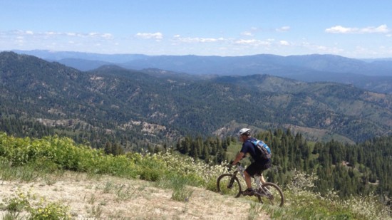
Being a mountain biker, I tend to head a little farther up in the trail system, but it’s rare I don’t see hikers out there as well. These mid-elevation trails tend to form longer loops, and among my favorite are those taking off from the Dry Creek Trailhead near Hidden Springs and Polecat Gulch Traihead (off Cartwright Road) and the Corrals, Miller Gulch and Dry Creek trailheads off Bogus Basin Road are also good jumping off points.
Depending on the amount of snow Bogus Basin gets during winter and spring weather conditions, trails in the upper Foothills typically open by June, which give you nice, cool hikes in the forest and access to upper elevations like Shafter Butte trails and Stack Rock.
Both newcomers to the Treasure Valley and old timers share a couple things. They’ve probably spent at least some time in the Foothills and experienced the trails, but they’ve also probably never hiked all of them, so there’s always more trails to explore. And they’re right out your back door just minutes away. There are no fees, no dues, and no excuses, so get out and enjoy them.
